Friday, June 20, 2014

Hiking at Bukit Agok on 20th June 2014

I have been planning to go on this trail for several weeks already, since I don't have a hiking buddy I had to reschedule the hike. 

This week I decided to go ahead and tried a new trail which I discovered from Sportstracker application. There were a few people who shared their hiking/hashing trip at Bukit Agok. As a precaution, I had informed my wife my plan trail and took general direction using compass direction to the beach (NW) and highway (SE) before the hike.

Location of trail head at Bukit Agok:
https://www.google.com/maps/dir//4.9064723,114.7963482/@4.9005388,114.7850507,4117m/data=!3m1!1e3!4m3!4m2!1m0!1m0


This was my original plan for the hike - from fellow hiker by the name of sharpshooter.
Me (as dot) on my planned trail (hahaha!!I'm really off the trail)
And below was what I ended up.. I did not use sportstracker to record my first half of the hike because I was using it to monitor the trail, when it was way out I decided to abandon my plan and just follow the hashing trail (white paper) and I went out from the jungle.

Video of the hike: http://youtu.be/foFgLS8Makc


Photo of the hike: check out my google+ (click here)
Turned on my sportstracker halfway, after I lost the planned trail.
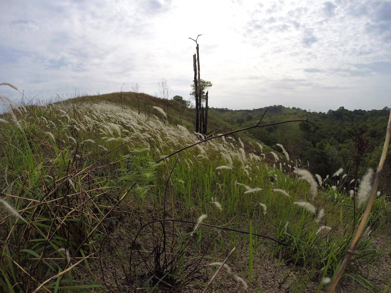
@Bukit Agok - this site will be used for sighting of the moon on 27th June 2014.
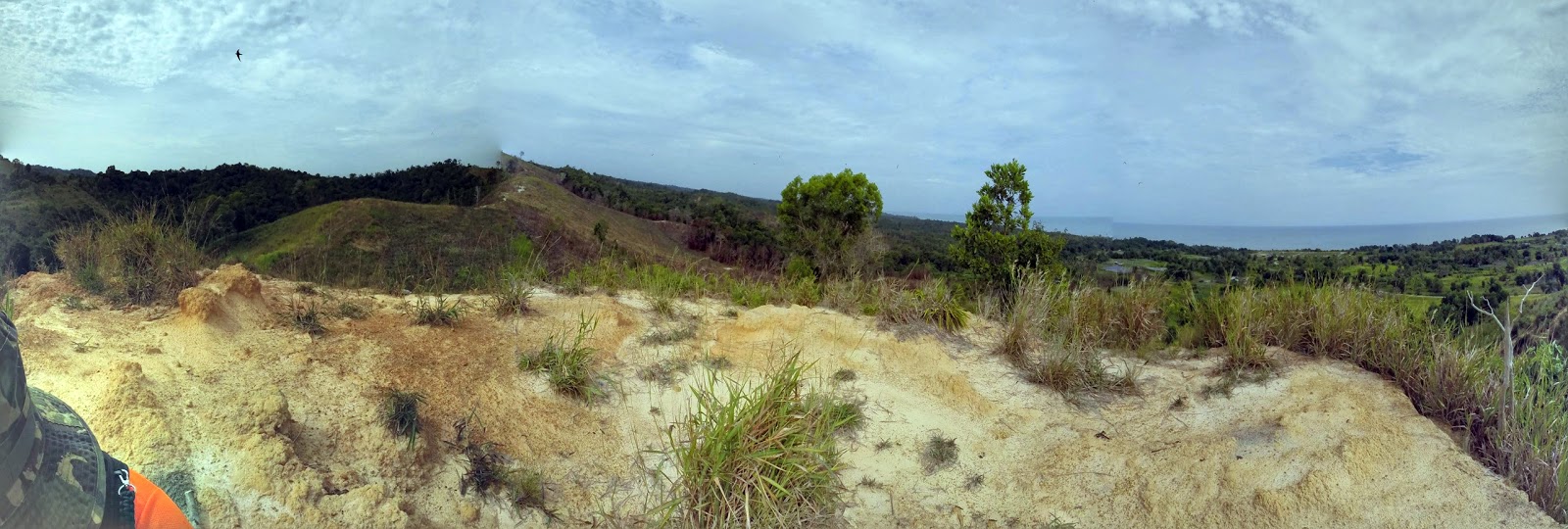
View towards Perumahan Lugu 


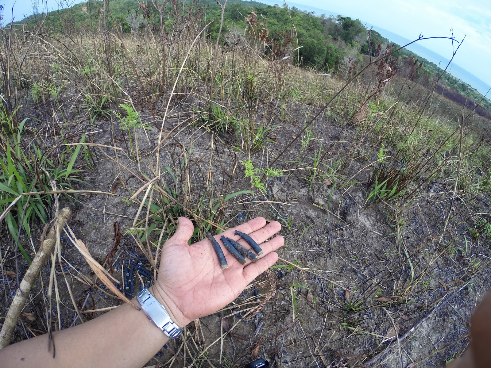
Used M-16 shells littered the hills around Bukit Agok - it looks like a training ground for soldiers


Sunday, June 15, 2014

Hiking at Labi trail near Biodiversity Center

A total of 9 hikers participated in our monthly group hike, this time Dinah helped to organise the event and we chose a trail along Jalan Labi (near Biodiversity Center). It was an easy 4 km hike where we crossed a few rivers and there was 1 hill slightly steep. We saw a few rundown facilities (rest area) along the trail indicating that it was a not a popular compared to Taman Rekreasi Sungai Liang.

Date: 15th June 2014 (Sunday)
Time: 7.30am-7:45am (gathered at Taman Rekreasi Sg.Liang - waiting for our guide)
Location of Labi Trail near Biodiversity Center via Google Map: https://www.google.com/maps/dir//4.6408036,114.5105764/@4.6409056,114.5070731,1083m/data=!3m1!1e3!4m4!4m3!1m0!1m0!3e2

Hike trail - via Sportstracker


Video of the hike: http://youtu.be/WkxeS3yrMpc


Photos of the hike in Google+
https://plus.google.com/photos/100296027471433861071/albums/6025011312612533969

Group photo (L-R): Rahmah (Guide), Zofian, Dinah, Shirley's friend, Shirley, Shala, Shala's friend, Shy, me


The group entering the trailhead

Under the forest canopy most of the time

First stop: Feeding the fish

Dinah's pose

Ants house (need to confirm)

Second stop: After climbing 1 hill (the only hill in this trail).


Group pose on top of log  while crossing a small river.

Finished the 4 km hike!!

Makan at Malabar restaurant - Special thank you to shy for the treat.

Sunday, June 1, 2014

Hiking at Bukit Shah Bandar - Bukit 1 to 10 (Menara)

I went for a short hike today at Bukit Shah Bandar because I had wedding invitation at 11 am. The park was pretty quite today, normally it was packed with hikers at the early hours.

One of the popular trails in Brunei for hikers.  Bukit Shah Bandar is still my favourite trails giving splendid views and panoramas overlook South China Sea, Kg Jerudong, Mc Farm Trail, MOF, MOD, Kg Rimba, JIS, Empire Hotel.

Video from the hike:
http://youtu.be/uLXxWiLgZUc


Pictures from my Google+ https://plus.google.com/photos/100296027471433861071/albums/6019783634354704721


Map of the trail at carpark near the stalls

Trail head


Background is the extended trail from Hill 4 to Hill 5 ~ 3.5 km


It was a lovely day
At Pondok 5
Resting at Pondok 9

At Hill 10 (Menara)


dd